 Eighteen Days in Hudson Bay are shown in the above animation. In the lower center, Hudson Bay more than doubled its ice extent up to 1.07M km2, 85% of maximum. Just to the northeast, Hudson Strait and Ungava Bay are almost frozen over, with Baffin Bay reaching down. At the top right you can see Greenland Sea ice reaching out toward Iceland.
The remarkable growth of Arctic ice extent in November 2018 overcame the October deficit, went 400k km2 over the 11 year average and exceeded all but one year in the last decade. The graph below compares the last 12 November ice extents.

The monthly average of all November days shows 2018 matching the 11 year average, slightly higher than 2007, and 1M km2 greater than 2016. The graph below shows the daily growth of ice extents throughout November, on average and for some important years.

2018 ice growth slowed so that it only slightly exceeded the 11 year average at month end. At 11.15M km2, it was higher than other recent years, 1M km2 greater than 2016.

Dr. Judah Cohen at AER posted on Dec. 3 explaining the November dynamics. Excerpts in italics with my bolds.
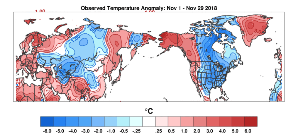
Figure i. Observed surface temperature anomalies 1-29 November 2019.
In the month of November there were two distinct pulses of vertical energy transfer from the troposphere to the stratosphere that resulted in a perturbation of the stratospheric PV and a displacement of the PV towards Eurasia with an elongation towards eastern North America and a warming centered near Alaska and Northwestern Canada. However, those pulses were not simply absorbed by the polar stratosphere but in large part ricocheted or reflected off the stratospheric PV and back into the troposphere. So that in large part forced a similar pattern in the troposphere that it did in the stratosphere. The vertical energy transfer and the subsequent boomerang back down creating a similar pattern in both the stratosphere in troposphere happens very quickly over a matter of days. The tropospheric pattern of ridging near Alaska and western Canada with troughing in eastern North America and the northerly flow between the two atmospheric features delivered a relatively cold November to Eastern Canada and the Eastern US (see Figure i).
But now we have a new month and still more active vertical energy transfer as indicated by the red shading in Figure 11. For the first half of December there are predicted two or three distinct vertical energy pulses. But what is missing so far for the month of December is any blue shading, these waves are not being reflected or ricocheting off the stratospheric PV but are almost completely being absorbed in the stratosphere. This wave energy should therefore have a bigger and more lasting impact on the stratospheric PV. From Figure 10 we can already see hints of this. For the first time this fall and now winter 2018/2019 the polar cap heights are predicted to be above normal in the middle stratosphere. But my expectation is that this latest perturbation of the stratospheric PV will be evolving for weeks and not days and the peak will likely occur either in late December or early January. Also the eventual impact on the troposphere will be weeks and not days.
But because there is no reflecting or returning signal from the stratosphere what is dominating the troposphere is the thermal advection or the migration of air masses across the NH. As I discussed last week and again today this transport of heat is usually characterized by a cold East Asia and western North America and a mild eastern North America and if you look at Figures 3, 6 and 8 this is generally the temperature pattern that is being predicted over the next two weeks with the focus of the cold across Siberia, East Asia and Alaska. Eastern North America is predicted to turn much milder starting next week. I am not as sure what is the impact for Europe during active vertical energy transfer and I thought maybe mild but the forecast for Europe is vacillating between mild and cold but turning milder across Northern Europe.
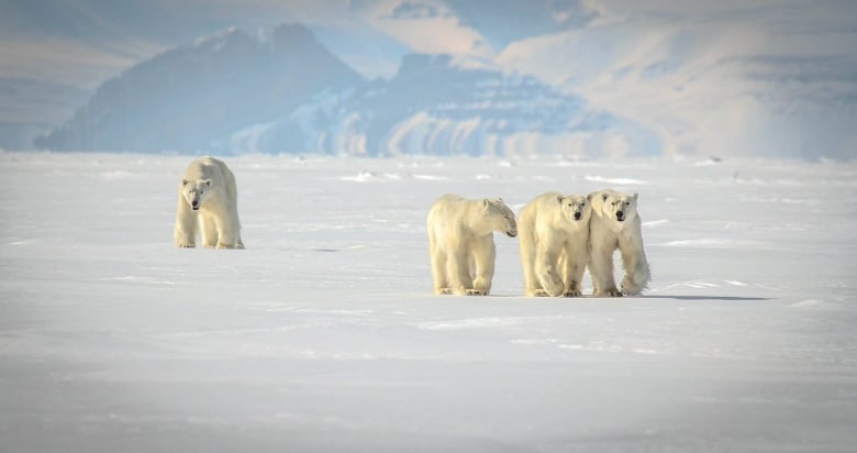
Meanwhile, in Nunavut, it is a great time to be a polar bear, even more of them than people want.

Thank you for this interesting summary and your other posts.
LikeLike
Edward, Good to hear of your appreciation.
LikeLike
Reblogged this on Climate Collections.
LikeLike